About GeoHistoric
GeoInformation Historic Ltd was established in 1998, as a subsidiary of The GeoInformation Group Ltd, specialising in historical sources and their application to innovative geospatial solutions. With the sale of the parent company to Verisk inc in 2016, the company became a dormant independent entity, until it started trading in 2020 as GeoHistoric.
Dr Seppe Cassettari was CEO of The GeoInformation Group and Chris Going was formerly Managing Director of GeoInformation Historic. They are now partners in the newly launched GeoHistoric.
Our backgrounds
Dr Seppe Cassettari
Seppe has over 40 years experience in the mapping and geospatial industry. Having recently retired from his role running Geomni UK, he is now working part time as a consultant and training specialist.
His career started with the UK military where he worked for 10 years in various mapping and geo-intelligence roles, during which time he completed one of the UK’s first PhDs in GIS. He then went on to run the ground breaking GIS undergraduate programme at Kingston University before being head hunted to run Longman GeoInformation for the publishers Pearson.
Following a management buy-out he became CEO of The GeoInformation Group in 1998 which went on to publish geospatial datasets and undertake many projects in the UK and abroad. The company is best known for the early aerial imagery databases developed in the mid 1990’s, published as Cities Revealed, and more recently the UKMap large scale topographic map base and the UKBuildings database of building type and age. The company also created the telecoms clutter data used by many mobile operators in the UK. The GeoInformation Group was sold to Verisk Inc. in 2016.
Seppe continues with his interest in mapping, writing regularly for the GeoConnexions magazine and being involved in the British Cartographic Society.
Chris Going
Chris Going graduated with a joint honours degree from the University of Wales (UCNW) in 1976 and worked as an archaeologist, initially with the Board of Celtic Studies, Cardiff, before joining archaeological field Units in his native Essex working principally with the Chelmsford Archaeological trust.
After moving to Cambridge in 1990, he undertook project and consultancy work with English Heritage, and the Central Archaeological Unit. During this time, he further developed long standing interests in aerial archaeology and landscape archaeology, becoming an executive member and sometime chair of the National Association of Air Photo Libraries (NAPLIB), consulting during this time to Academic and other organisations with substantial archives of aerial imagery. From the mid-1990s he brought his work more up to date by developing methodologies for the creation of UXO/EROW (explosive remnants of war) ‘peril maps’ becoming latterly a Director of Cambridge Architectural Research (CAR Ltd) where he carried out projects on EROW mapping in the Netherlands and Italy.
In 2000 he joined GeoInformation Historic, then a subsidiary of the GeoInformation Group, as Director, where he developed ways of using archived aerial imagery more commercially. At the same time, with then Group CEO Dr Seppe Cassettari, he came up with unique ways to characterise UK and oversees building stock. This continues to be an active area of research.
Industry Leadership
European Association of Aerial Survey Industries (EAASI)
Dr Seppe Cassettari was invited to be on the European panel of judges for the "GeoSpatial Business Bridge" Outstanding Thesis Award for 2024 and 2025.

Dr Cassettari President
of British Cartographic Society
for 2021-2024
Thought Leadership
Recent publications and presentations
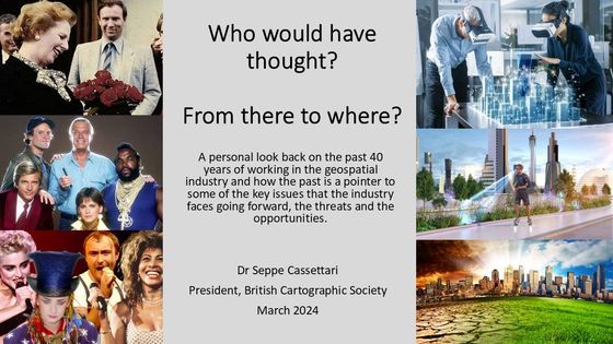
A Viewpoint presentation given to the British Cartographic Society as part of their Teatime Talk series in March 2024 (which is available on the BCS YouTube channel) and subsequently at the Cymru Cartographic Conference in Aberystwith, May 2024.
The presentations looked back over a 40 year career to consider some of the changes that have ocurred within the Geospatial world and considered what are some of the most challenging issues that we currently face.
Cartographic Journal Article
After Seppe Cassettari's president's address at the end of his term as President of the British Cartographic Society and subsequent presentation to the Cymru Cartographic Conference in May 2024 a version was published in the Cartographic Journal Vol 61 No 2 pp168 - 175 in May 2024.
Cartographic Journal Special Issue
UKCC National Report to ICA 2019-2023
Seppe Cassettari, together with Alexander Kent and Christopher Budas, compiled and edited the UK Cartographic Committee (UKCC) National Report to the International Cartographic Association for the period 2019 to 2023. It was published as a Special Issue of the Cartographic Journal Vol 60 No 2 May 2023 and is available from Taylor and Francis at:
https://www.tandfonline.com/toc/ycaj20/60/2
GeoConnectionUK and GeoConnection International
regular column
Seppe Cassettari had a regular column in GeoConnexionUK and GeoConnection International magazine.
Here are the links to the 2020 and 2021 articles
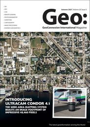
Autumn 2021
The importance of grids, spheroids and datums
'Seppe Cassettari argues that we need to better understand the importance of the grid systems we use as the basis for datasets and their likely impact on accuracy and consistency when used in a wider context.'
https://www.geoconnexion.com/publications/autumn-2021-int-issue
July/August 2021
Risky Business
'Most of us wouldn't dream of buying food in a supermarket without at least considering the 'Best Before' and 'Use By' dates. So why should we be expected to usemaps or geospatial data when we know so little about their sources and overall quality? It's all a matter of risk says Seppe Cassettari'
https://www.geoconnexion.com/publications/july-august-2021-int-issue

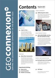
May/June 2021
The importance of archives
'Seppe Cassettari argues that by learning and applying lessons from the past, we can help future generations avoid the need to re-invent the wheel'
https://www.geoconnexion.com/publication-articles/the-importance-of-archives
March/April 2021
Enhanced Topographic Mapping
'Seppe Cassettari wonders how large scale mapping might be improved ….
and takes inspiration from an unexpected quarter'
https://www.geoconnexion.com/publication-articles/enhanced-topographic-mapping
January/February 2021
Speaking with many voices
'Seppe Cassettari suggests that it is time for our professional and trade associations to rethink their role and how they measure-up to the task'
https://www.geoconnexion.com/publication-articles/speaking-with-many-voices

November/December 2020
DIY GIS
'Seppe Cassettari says that while a bad craftsman will always blame his tools, it’s having the nous to use them correctly that is fundamental to success, not least in GIS'
https://www.geoconnexion.com/publication-articles/diy-gis
September/October 2020
Stand and deliver!
'Seppe Cassettari sets his sights on Britain’s muddled and costly addressing system and argues that enough is enough'
https://www.geoconnexion.com/publication- articles/stand-and-deliver-1

July/August 2020
Mapping the message
'While maps can deliver complex information in a simplified, easily digestible form, Seppe Cassettari suggests that more work is needed to ensure they convey clear messages in a rapidly unfolding pandemic'
https://www.geoconnexion.com/publication-articles/mapping-the-message
May/June 2020
Future Planning, Historic Context
'Seppe Cassettari reflects on the need for a detailed, comprehensive national land use database, and believes the time is right to put words into action'
https://www.geoconnexion.com/publication-articles/future-planning-historic-context
March/April 2020
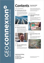
A geo-passport for your property?
' Seppe Cassettari suggests that applying some joined-up thinking in the conveyancing process could plug existing gaps in data consistency, currency and quality'
https://www.geoconnexion.com/publication-articles/a-geo-passport-for-your-property
January/February 2020
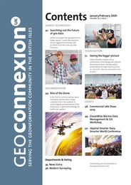
Rise of the drone
'In the first of a series of articles about innovation and the future, Seppe Cassettari traces the evolution of aerial imaging and how the rise of the drone poses a significant challenge for traditional suppliers'
https://www.geoconnexion.com/publication-articles/rise-of-the-drone
